Loading intel...
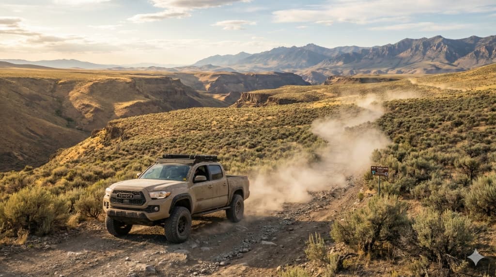
Idaho Offroad Headquarters
32 Million Acres of
Public Land.
Navigate Idaho's vast network of BLM roads, forest service routes, and backcountry trails. Find dispersed camping spots, plan overland routes, and explore the wildest corners of the Gem State.
Quick Start
Plan With Roam Idaho
Overlanding Gear
Recovery, navigation, sleep system, and the rest of the kit that turns a 4WD into a basecamp.
Public Land Guide
BLM vs Forest vs State endowment lands — what you can drive on and where to verify it.
Idaho GMU Map
Plan dual-purpose trips by overlaying hunting unit boundaries with offroad routes.
Browse by Region
Featured Adventure Trails
View Alleasy 103 miles
View Trail
Owyhee Backcountry Byway
A remote and scenic backcountry byway through the Owyhee Mountains, offering stunning high desert landscapes, historic mining towns like Silver City, and abundant wildlife viewing opportunities. High clearance recommended but typically passable in dry conditions.
Silver City ghost townHigh desert sceneryWildlife viewing
moderate 150+ miles
View Trail
Danskin Mountains OHV Area
Extensive OHV trail system featuring sandy washes, rocky climbs, and technical single-track. One of Southwest Idaho's most popular riding areas with trails for all skill levels. Mix of BLM and state land.
Technical single-trackSandy terrainMultiple trail loops
difficult 101 miles
View Trail
Magruder Corridor
The legendary Magruder Road connecting Idaho and Montana through the Frank Church-River of No Return Wilderness. A true adventure route requiring 4x4, no services, and remote wilderness conditions. One of the most scenic and challenging routes in the West.
Frank Church WildernessRemote wildernessEpic scenery
moderate 10,600 acres
View Trail
St. Anthony Sand Dunes
One of America's premier sand dune riding destinations. Massive white quartz sand dunes up to 400 feet tall offering endless riding opportunities. Popular for ATVs, dirt bikes, and sand rails. Camping available on-site.
400-foot dunesWhite quartz sandCamping on-site
Vehicle Classifications
Highway Legal
Any street-legal vehicle. Paved and maintained gravel roads.
Highway 21, Ponderosa Pine Scenic Byway
High Clearance
8"+ ground clearance. Unmaintained gravel and dirt roads.
Most BLM roads, forest roads
4x4 Required
Four-wheel drive essential. Rocky, steep, or washed-out sections.
Magruder Corridor, primitive roads
ATV/UTV Only
Designated OHV trails. Not accessible to full-size vehicles.
Designated trail systems
Backcountry Safety
- • Tell someone your plans. Cell service is nonexistent in most backcountry areas.
- • Carry recovery gear. Traction boards, straps, shovel, and a full-size spare at minimum.
- • Bring extra fuel and water. Gas stations may be 100+ miles apart.
- • Check conditions. Roads can be impassable due to snow, washouts, or fire closures.
- • Carry paper maps. GPS and cell service are unreliable in remote areas.
Frequently Asked Questions
Can I camp anywhere on BLM land in Idaho?
Generally yes. Dispersed camping is allowed on most BLM land for up to 14 days in any 28-day period. You must be at least 25 feet from water sources and avoid blocking roads or gates. Some areas near sensitive habitat or popular recreation sites may have specific restrictions.
Do I need a permit for dispersed camping in National Forests?
No permit is required for dispersed camping in most National Forest areas. The 14-day stay limit applies. However, some wilderness areas require free permits for overnight stays, and fire permits may be required during high fire danger periods.
What is an MVUM and why does it matter?
The Motor Vehicle Use Map (MVUM) is the official map showing which roads and trails are open to motorized vehicles on National Forest land. Travel is only allowed on designated routes shown on the MVUM. Using unauthorized routes is illegal and subject to fines.
Can I drive on BLM land anywhere I want?
No. While BLM land has more open travel than National Forests, you must still stay on designated routes in areas with travel management plans. Cross-country travel is prohibited in many areas. Check the specific BLM field office for travel regulations in your area.
What should I bring for backcountry travel in Idaho?
Essential items include: full-size spare tire, recovery gear (traction boards, straps, shovel), extra fuel, water (1 gallon per person per day minimum), paper maps/GPS, first aid kit, fire extinguisher, and communication device (cell service is often unavailable).
When are forest roads open in Idaho?
Most high-elevation forest roads are closed by snow from November through May or June. Lower elevation BLM roads are typically accessible year-round but may become impassable during spring mud season. Always check current conditions before heading out.
Plan Your Route.
Open the interactive map to layer BLM land, forest boundaries, and terrain data. Find your perfect backcountry escape.
Launch Trail Finder